Merkliste
Die Merkliste ist leer.
Der Warenkorb ist leer.
Kostenloser Versand möglich
Bitte warten - die Druckansicht der Seite wird vorbereitet.
Der Druckdialog öffnet sich, sobald die Seite vollständig geladen wurde.
Sollte die Druckvorschau unvollständig sein, bitte schliessen und "Erneut drucken" wählen.
Insight Guides Flexi Map California
ISBN/GTIN

Insight Guides Flexi Map California

KarteKarte (Landkarten, Stadtpläne)
Verkaufsrang2099inKarten und Atlanten
CHF11.90

Produktinformationen

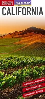
Fleximap California is a laminated, tear-resistant map which includes 3 individual maps, each with a separate index, categorised for ease of use. California is shown on two maps, one for the South of the State and one for the North, both maps have a scale of 1:1 150 000. Yosemite National Park is shown on a separate map at a scale of 1:520 000. Places of interest are clearly highlighted and named. In addition to the mapping, Fleximap California also gives a list - with descriptions and some photographs - of 17 recommended sights, divided by theme and linked to the mapping by numbered markers. There is also a handy information section with concise details on getting around, tourist offices, money, tipping, opening times, public holidays, rules of the road, emergency telephone numbers and climate.
Weitere Beschreibungen

Details

ISBN/GTIN978-1-78005-564-0
ProduktartKarte
EinbandKarte (Landkarten, Stadtpläne)
Erscheinungsdatum01.01.2013
Seiten2 Seiten
SpracheEnglisch
WarengruppeReisen
Weitere Details

Kritiken und Kommentare

Schlagworte

Vorschläge

Zuletzt von mir angeschaut