Merkliste
Die Merkliste ist leer.
Der Warenkorb ist leer.
Kostenloser Versand möglich
Bitte warten - die Druckansicht der Seite wird vorbereitet.
Der Druckdialog öffnet sich, sobald die Seite vollständig geladen wurde.
Sollte die Druckvorschau unvollständig sein, bitte schliessen und "Erneut drucken" wählen.
Real Estate and GIS
ISBN/GTIN

Real Estate and GIS

The Application of Mapping Technologies
eBookPDFElectronic Book
Verkaufsrang18631inNatural Science (eBook)
CHF108.35

Produktinformationen

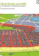
Real Estate and GIS focuses on the application of geographic information systems (GIS) and mapping technologies in the expanding property and real estate discipline. Whilst a thorough understanding of location is understood to be fundamental to the property discipline, real estate professionals and students have yet to harness the full potential of spatial analysis and mapping in their work. This book demonstrates the crucial role that technological advances can play in collecting, organising and analysing large volumes of real estate data in order to improve decision making.
Weitere Beschreibungen

Details

Weitere ISBN/GTIN9781317284055
ProduktarteBook
EinbandElectronic Book
FormatPDF
Erscheinungsdatum17.07.2018
Auflage18001 A. 1. Auflage
Seiten246 Seiten
SpracheEnglisch
Dateigrösse29848 Kbytes
Illustrationen40 schwarz-weiße Fotos, 44 schwarz-weiße Zeichnungen, 26 schwarz-weiße Tabellen
WarengruppeEnglish
Weitere Details

Kritiken und Kommentare

Über die Autorin/den Autor

Richard Reed is Professor and Chair of Property and Real Estate at Deakin University, Australia. He is a registered property valuer and is also the editor of the International Journal of Housing Markets and Analysis and author of the best-selling textbook Property Development, now in its sixth edition.

Chris Pettit is Professor and Chair of Urban Science at the University of New South Wales, Australia. He is on the board of directors for the CUPUM (Computers in Urban Planning and Urban Management) conference, a board member of the International 'Geo for All' initiative, Co-Chair of the Research Data Alliance (RDA) International Working Group on Urban Quality of Life Indicators and Co-Chair of the International Society for Photogrammetry and Remote Sensing (ISPRS) Working Group on Geographical Visualization and Virtual Reality.

Vorschläge

Zuletzt von mir angeschaut